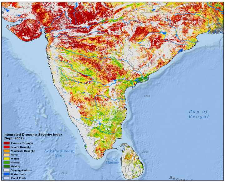
The South Asia Drought Monitoring System (SADMS), established in 2014, is a weekly map of drought conditions that is produced and maintained at the International Water Management Institute (IWMI). Numerous drought indices - including the Integrated Drought Severity Index, Standardized Precipitation Index, and Soil Moisture Index - have been developed to provide advanced drought monitoring and assessment information for various purposes. In tandem, these indices not only paint an accurate picture of any particular drought episode, but provide invaluable decision-making tools.

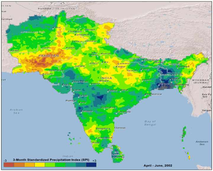
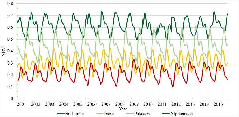
Through the SADMS website, the International Water Management Institute (IWMI) provides a wide array of precipitation and related information garnered primarily from the freely available satellite imagery to improve current capabilities in drought monitoring and prediction and provide regional to district scale information about drought's effect on agriculture. The drought severity maps that are produced deliver continuous geographic coverage over large area for the first time, and have inherently finer spatial detail (500m resolution) than other commonly available global drought products such as NESDIS NOAA, MODIS Global Terrestrial Drought Severity Index using different data and approaches.